
Google Earth review
 Analysis by GetAllApps
I use Google Earth when a place is more than a dot on a route and I want to understand its shape, surroundings, or setting before I go. It is a free travel and local app from Google LLC, but it serves a different purpose from a turn-by-turn navigation tool: its strongest feature is letting me explore the world visually. That distinction matters. If I need a quick route while driving, I reach for a dedicated navigation app; if I want to see how a coastline curves around a town or how a mountain pass sits in the landscape, this is the more engaging choice.
Choose it for exploring, not just getting there
Before installing it, I would ask one simple question: do I want directions, or do I want perspective? Google Earth is built for the second. The ability to move between a broad view of a region and a closer look at individual places makes it useful for travel planning, curiosity, and learning—not just for checking where an address is.
That changes how I use it. When planning a weekend away, I might first search for the destination, then pull back to see nearby towns, water, and terrain. A route on a conventional map can tell me where roads go, but the larger view helps me judge whether a place feels coastal, remote, mountainous, or close to other stops. It cannot replace checking current travel conditions, but it can make the early planning stage more informed.
The app is free, and its Everyone age rating makes it accessible for families as well as solo explorers. Its broad reach is reflected in over 500 million installs, while its average rating is 3.8 from around 3 million ratings. Those figures suggest a widely used tool with a mixed range of expectations: some people open it for occasional discovery, while others may expect it to behave like a live navigation app.
What makes the globe view worthwhile
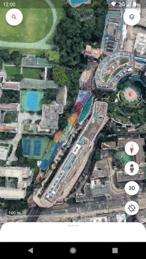
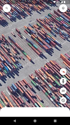
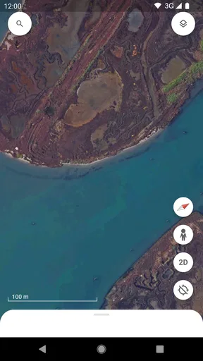
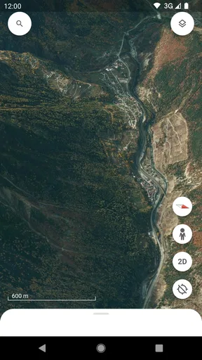
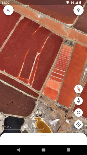
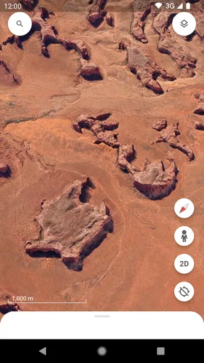
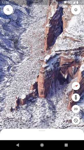
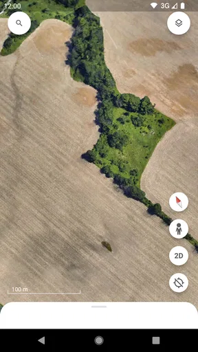
The central pleasure is spatial context. Instead of seeing a place only as a label on a flat map, I can rotate and zoom around the globe, then follow the landforms into a closer view. This is especially satisfying for places whose identity comes from geography: islands, river bends, mountain ranges, peninsulas, and sprawling cities. It turns “Where is it?” into “What is around it, and how does it fit into the landscape?”
One practical tip is to explore outward as well as inward. A close view of a hotel or landmark may answer one question, but zooming out can reveal whether it is near a larger town, separated by a ridge, or part of a wider cluster of places. I find that useful when choosing which area to stay in, particularly when a destination name covers a much larger region than I first assumed.
Another good workflow is to use it before switching to a route planner. I can get a feel for the geography first, identify a few places worth visiting, and then use a navigation app for the actual journey. Keeping those jobs separate avoids a common frustration: expecting a visually rich exploration tool to provide every detail needed for a live trip.
Useful beyond vacation planning
Google Earth also suits a short, everyday moment of curiosity. If a friend mentions a town, I can look at its setting; if I hear about a famous natural feature, I can trace its surroundings. For a student, it can help connect a place name in a book or lesson with a recognizable landscape. For a family, browsing together can prompt questions about how coastlines, cities, and terrain differ from one region to another.
I also like it as a first step when considering a move or a day trip. A quick look can help me notice whether an area appears compact or spread out, whether green space sits nearby, or whether a destination is tucked among hills. Those visual impressions are not a substitute for visiting, reading local information, or checking current conditions. They are a way to arrive at better questions before making a decision.
There is a useful trade-off here: a dramatic aerial perspective can make a place feel clearer, but it does not automatically tell me what it is like at street level. A landscape view can show the broad arrangement of a neighborhood without answering practical questions such as how easy it is to walk between two buildings. I treat the app as a context tool, not as proof that a route or location will suit my needs on the ground.
Where other map apps may be a better fit
For a driver who needs spoken, turn-by-turn directions and quick route decisions, a navigation-focused app is usually the better starting point. Google Earth’s appeal is visual exploration rather than keeping attention on a changing route. Likewise, if I am comparing transit connections, checking a nearby business, or looking for immediate local details, a conventional map app designed around those tasks may be faster and more direct.
Travelers who mainly need a dependable offline reference should also think carefully about which app they rely on. A globe view is most valuable when the imagery and detail can be explored as intended, so I would not make it my only travel resource in a place where connectivity may be unreliable. I would prepare directions and essential destination information separately rather than assume that visual browsing will cover every need.
There is a second kind of alternative: specialized tools for planning hikes, measuring land, or researching a specific location. Those may be more suitable when the task depends on precise, task-specific information. Google Earth is compelling for seeing the broader picture, but I would not treat it as a replacement for a specialist resource when accuracy, current access conditions, or field navigation are central to the decision.
Small frictions that affect the experience
The same freedom that makes the app enjoyable can make it less efficient. It is easy to keep zooming and rotating without settling on an answer, especially when I begin with a vague search such as “somewhere scenic.” I get more from it when I start with a specific question: Is this town close to the coast? What lies beyond this valley? How are these two destinations positioned relative to one another?
Visual exploration also takes more attention than checking a simple list or route. On a small screen, I sometimes need to adjust the view more than once before the geography makes sense. That is part of interacting with a three-dimensional globe, not a reason to dismiss the app, but it does mean that someone who wants a quick, minimal map may find a standard two-dimensional view more comfortable.
Image interpretation has limits, too. Aerial imagery gives a strong sense of shape and location, but it can leave practical details unresolved. If I am deciding whether a path is open, whether a venue is operating, or how conditions look today, I look for a current source suited to that question. My most reliable habit is to use Earth to understand the setting, then confirm time-sensitive details elsewhere.
Switching habits without replacing everything
If you already use another map app, there is little reason to abandon it. I would add Google Earth alongside it and give each tool a clear job: use Earth to investigate a place and understand its surroundings, then return to your usual map for directions or local logistics. That approach has a low learning cost because it does not require changing the routine that already works.
The biggest adjustment is expectation, not technique. Someone used to tapping a destination and immediately following a route may initially wonder why the globe view is not as direct. Once I stop asking it to be a navigation app, its strengths become easier to appreciate. Conversely, if I find myself opening it only to check an address, it is probably not adding much to my routine.
Google LLC has developed an app that feels most rewarding when I give myself room to look around. I do not need a complicated plan: search for a place, orient myself, and follow the landscape outward. The practical value comes from using that visual context to make a better-informed next step, rather than expecting one app to answer every travel question.
My recommendation depends on what you want to see
I recommend Google Earth to curious travelers, students, families, and anyone who enjoys understanding the shape of a place before visiting. It is also a good companion for people who like to explore destinations without committing to a route. Its travel-and-local focus is broader than navigation, and its free price makes it easy to try without turning it into a major decision.
I would skip it as a primary tool if your main need is fast directions, live trip management, or a specialist outdoor workflow. In those cases, the usual navigation or activity-specific alternative is a more natural fit. I would also avoid judging a destination solely from its aerial appearance; use the app to build context, then check the details that matter to your actual plans.
For me, the clearest reason to keep it installed is that it changes the questions I ask about a place. Instead of only asking how to get there, I can see what surrounds it and why its location matters. Google Earth is at its best as a visual companion to ordinary maps: not a universal replacement, but a distinctive way to explore the world and plan with a little more perspective.
Pros and cons
Pros
- Explore detailed satellite imagery from around the world.
- Use Street View to see ground-level scenes in many locations.
- Measure distances and areas directly on the map.
- Save places and organize them into custom projects.
- Works on Android and iOS with a free download.
Cons
- Some imagery may be outdated or low resolution.
- Street View coverage varies widely by location.
- High-detail views can use significant mobile data.
- The app may feel slow on older devices.
- Some features work best with a stable internet connection.


